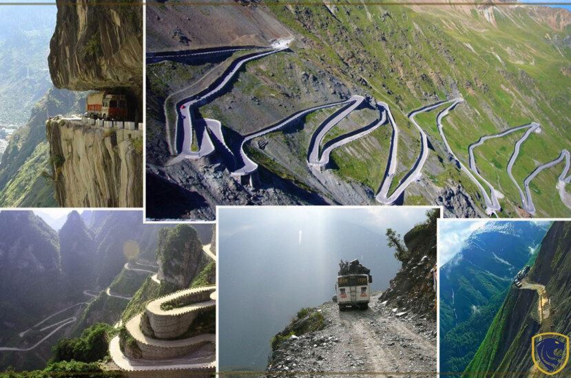
Roads can be scenic and comfortable and also dangerous and haunted. This article is about the world’s most dangerous road tracks. Most of these routes offer scenic views. But there have been several accidents and deaths due to their geographical settings. If you like adventurous trips, these will be the perfect set of options for you.
BAYBURT D915- TURKEY1
There are no fences or other obstacles along the 29 hairpin turns of this 66-mile route to stop automobiles from driving off the edge. Due to its risk factor, dangerousroads.org has declared it the world’s most deadly road, surpassing the Yungas route in Bolivia. Due to snow blizzards and hazardous weather, portions of the route are blocked throughout the winter. There is no space for mistakes on this route, which will put all drivers to the test in terms of ability and bravery.
When traveling on the most hazardous road in the world, you may encounter threats including avalanches, landslides, and significant snowfall. The Bayburt Highway is a functional route that is utilized by residents traveling in all types of vehicles. The route has claimed many lives recently and is truly a highway to hell, earning it the distinction of the most unsafe road in the world on our list! Which route would you dare to travel?
BAYBURT D915- TURKEY1
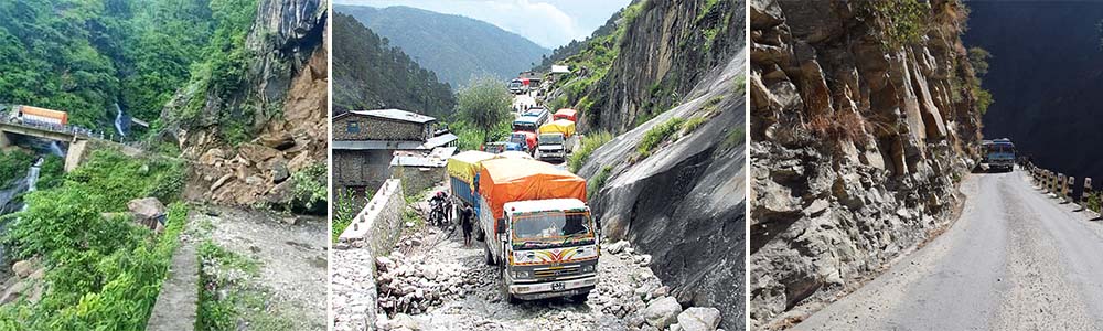
Killar to Pangi Road, via Kishtwar (India)
Only those with steely nerves and a love of driving in the highlands should attempt this nerve-racking road. This rough, gravelly route, which is only open in the summer, is around 70 miles long. It is particularly dangerous in a six-mile section where rocky overhangs seem ripe for the taking. The road was constructed by the local people hundreds of years ago, and throughout the years it has not been restored.
This dirt and gravel road, which is just wide enough for one jeep at a time, is terrifyingly unstable in certain parts. A driver’s one mistake may send a car drifting 2,000 feet down a mountainside. It gives us goosebumps, to see videos of people driving over this road since it is so terrifying. Make sure this is your final task if it’s on your bucket list! Uncertain about your readiness? More pictures and information about this treacherous road may be found in this travelogue about driving the Killar to Pangi road.
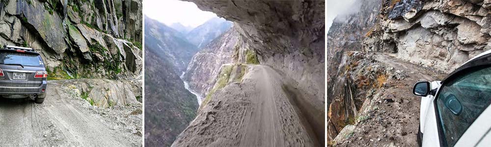
Killar to Pangi Road, via Kishtwar (India)
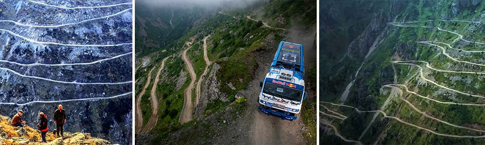
Col du Chaussy, France
Col du Chaussy, located in the Rhône-Alpes area of southeast France, is a high mountain range that begins with the renowned “Les Lacets de Montvernier.” It is 5,029 feet above sea level. Only roughly 2 miles long, this unique segment has 17 hairpin twists as you ascend a real cliff. As you zigzag uphill, there is a little concrete barrier, but while being absurdly attractive, this unlikely route is nonetheless among the world’s most hazardous. Here’s why there aren’t any stop signs on the Col du Chaussy in France.
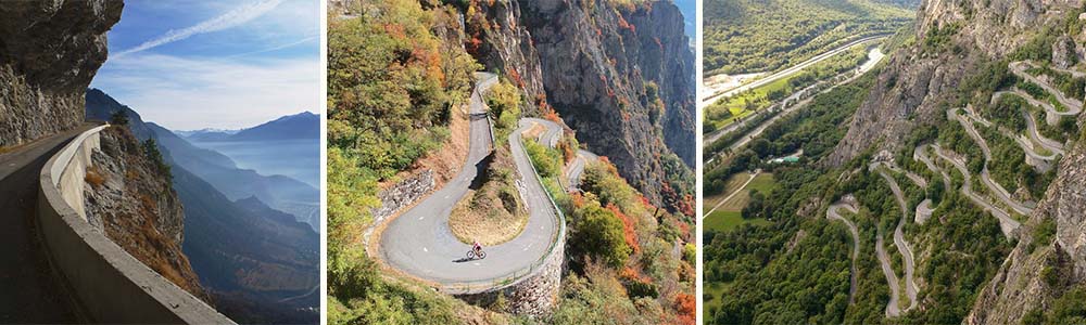
Col du Chaussy, France
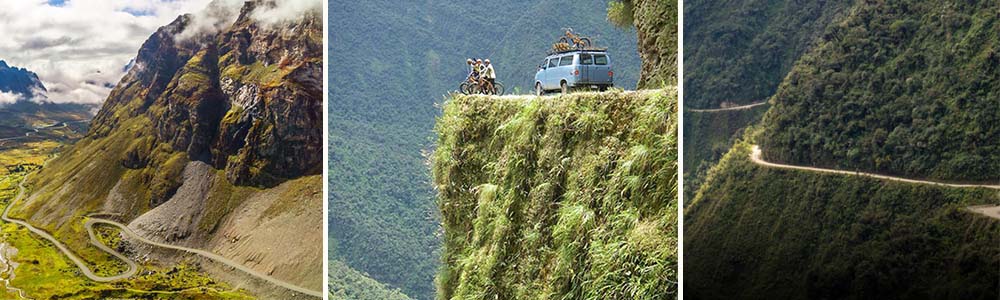
Yungas Road (Death Road), Bolivia
Between Coroico and La Paz, the Bolivian capital, lies a 43-mile section of road with the unsettling moniker “Death Road.” The route’s highest point is 4,650 meters (15,256 feet). Motorists frequently find themselves driving winding dirt roads well above cloud level.
It also has more than 200 vertigo-inducing hairpin curves, some of which have sheer drops of 1,100 meters, as if that weren’t awful enough. The greatest traffic catastrophe in Bolivian history—the bus veered into a canyon, killing 100 people—occurred on the Yungas Road. Before 1994, over 300 travelers each year perished on the roads.
Yungas Road (Death Road), Bolivia
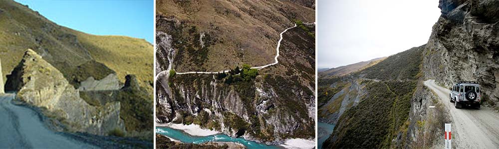
SKIPPERS CANYON ROAD- NEW ZEALAND
The 16.5-mile route, which is in the southwest of New Zealand, was manually dug by miners more than 140 years ago. Even your auto insurance won’t be honored if you drive on the road since it is so unsafe. Don’t forget your camera—the journey is worthwhile because it offers some of the most breathtaking photo settings! It is made of gravel and relatively narrow while being incredibly picturesque. The Skippers Canyon will put your driving skills to the test with its winding, narrow roads, high heights, steep slopes, and twisting hairpin turns. When taking on this one, it’s crucial to be ready due to its unusual and distant location, as well as the poor road conditions. Ten of the World’s Riskiest Roads
SKIPPERS CANYON ROAD- NEW ZEALAND
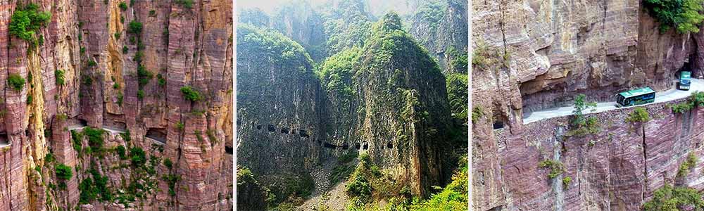
Guoliang Tunnel Road (China)
After the Chinese government determined it wasn’t worthwhile to go to the effort and expense of creating a road that would be used by only 300 inhabitants, thirteen of those communities made the decision to dig a 0.8-mile tunnel through the solid rock of a vertical cliff. The Taihang Mountains in Henan were home to the peasants, who used explosives to blow their way through this perilous precipice. Some of the villagers perished in accidents because they lacked expertise in constructing roads.
The tunnel is only just broad enough for two automobiles at 12 feet long by 15 feet high. The road was completed in five years and made accessible to traffic in 1977. Beware: When it rains, this route becomes particularly risky!
It’s interesting to note that this region of China has at least two more cliff-tunnel roadways.
Guoliang Tunnel Road (China)
Karnali Highway, Nepal
Around 50 people pass away here a year, making the 155-mile Karnali Highway in West Nepal’s Himalayas a real death wish. Even when it’s not monsoon season, this road is among the most deadly in the world. It is due to its highly dusty surface, which reduces sight. Narrow portions, landslides, falling boulders, flooded areas, potholes, enormous drops from cliffs, and severe geometric distortion. And now since driving at night has been outlawed by the police owing to the large frequency of tragic accidents, it is just a route that is most usable during the day. Although Nepal is one of the nations that is safer than you believe, this roadway is deadly.
Karnali Highway, Nepal
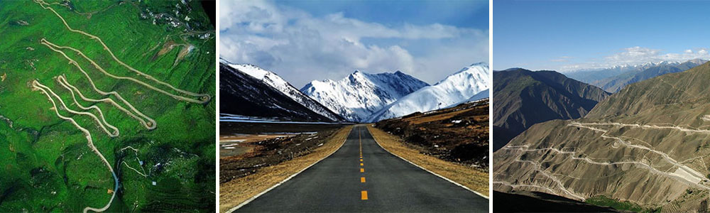
Sichuan-Tibet Highway, China
The Sichuan-Tibet Highway, with an average height of 4,000 meters (13,123 feet), has all the makings of one of the world’s most bizarre roadways.
Along the 1,330-mile path between Chengdu, Sichuan, and Lhasa, Tibet, rock avalanches and landslides are frequent occurrences. It might take up to 15 days to travel the whole length of the route.
It was said that a bus ran off the road in 2011, tragically killing 16 people.
Sichuan-Tibet Highway, China
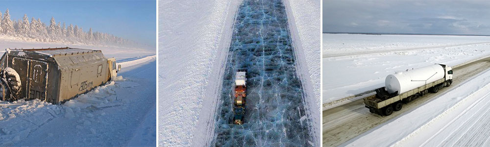
SIBERIAN ROAD TO YAKUTSK- RUSSIA
This Russian dirt route cuts into Siberia. Temperatures drop so low during the winter (which lasts for 10 months) that it becomes impossible to wear glasses because the metal will stick to your face. Mountains, woods, deserts, and more are all traversed by the route. Driving conditions deteriorate over the summer when the frozen road changes to mud. The road is covered with mud in July and August, engulfing automobiles. Motorists have no option because it is the only highway that leads to Yakutsk. Since the road is remote, having emergency supplies on hand is essential in case you become stranded. Amazingly, Only this road outside of Antarctica has ever recorded the lowest temperature.
SIBERIAN ROAD TO YAKUTSK- RUSSIA
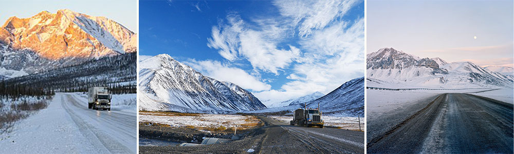
James Dalton Highway (Alaska)
The James Dalton Highway, also known as the North Slope Hall Road, is a route taken by trucks. Particularly those going to and from the Prudhoe Bay oil fields on Alaska’s north slope. In reality, the route is essential to the Trans-Alaska Pipeline System.
The 414-mile Highway has some paved sections, but around three-fourths of it is unpaved. There are just three towns along the route, and there are no medical services. Anyone going by car is recommended to pack a lot of supplies and a survival kit. Interestingly, a lot of the episodes of the reality TV series Ice Road Truckers dramatize the difficulties of traveling on this perilous, unpaved road.
James Dalton Highway (Alaska)